
What Is a Title Plan?
Written by Editorial Team · Last reviewed
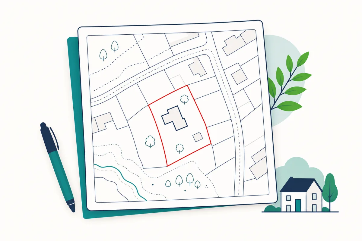
A title plan is the map that HM Land Registry keeps for each registered title in England and Wales. It shows the general extent of the land in the title, usually edged in red on an Ordnance Survey base map. It shows general boundaries rather than the precise legal boundary line, and it is designed to be read alongside the title register.
The title plan in plain English
When land or property in England and Wales is registered, HM Land Registry creates two documents for it: the title register, which describes the property in words, and the title plan, which shows it on a map. The plan is a graphical representation of the general extent of the land in the registered title, drawn on an Ordnance Survey base map.
The plan carries the same unique title number as the register — a reference such as AB123456 — so you can always match the pair together.
What you will see on a title plan
Most title plans share the same basic features:
| Feature | What it means | | --- | --- | | Title number | The unique reference for the registered title, matching the register | | Ordnance Survey base map | The background mapping showing buildings, roads and physical features at the date the plan was prepared | | Red edging | The general extent of the land in the title | | Other coloured markings | Tinting, hatching or edging in green, blue, brown and other colours, each explained by an entry in the register | | Scale and north point | The scale the plan was prepared at, with north normally at the top |
The red edging is the marking most people look for first. Other colours are not decorative: a strip tinted blue might be land affected by a right of way, and land edged green might have been removed from the title. You cannot tell which from the plan alone — the meaning is always set out in the register.
The general boundaries rule
This is the single most important thing to understand about title plans. Under the general boundaries rule, the boundary shown on a title plan is general unless it has been formally determined. The red edging tells you roughly where the boundary runs — along a hedge line, a fence, a wall — but it does not fix the precise legal line. It does not tell you, for example, which side of a hedge the boundary sits on, or who owns the boundary feature itself.
Determined boundaries, where the exact line has been agreed and registered, do exist, but they are rare and require a formal application to HM Land Registry. Unless the register says a boundary has been determined, assume the plan shows general boundaries only.
Scale and its limits
Title plans are prepared at fixed scales — commonly 1:1250 for urban properties and 1:2500 for rural land. At 1:1250, a line just half a millimetre thick on paper represents over half a metre on the ground. That is why HM Land Registry itself warns against scaling measurements from a title plan. If you need accurate dimensions, for an extension or a boundary question, a professional measured survey is the right tool; the title plan is not.
The Ordnance Survey base map also reflects the features that existed when the plan was prepared. Extensions, new fences or demolished outbuildings that came later will not appear.
Why the plan must be read with the register
A title plan on its own answers one question reasonably well: roughly what land is in the title. Almost everything else — who owns it, what rights and covenants affect it, and what the coloured markings mean — lives in the register. Ordering the plan without the register often leads straight to a second order, which is why many people get both documents together from the start.
How to get a copy
You can order a copy of the title plan through our service: give us the address, we check it by hand, identify the registered title — and contact you first if more than one title could match — then deliver the PDF through a secure link. You can also buy directly from HM Land Registry, which usually costs less; our fee covers the human address checking, retrieval, secure delivery and support.
If you want the full picture, order the title plan together with the title register, because each document is written on the assumption that you have the other.
What Is a Title Plan? — FAQs
Does a title plan show exactly where my boundary is?
Usually not. Almost all title plans show general boundaries, which means the red edging indicates the general position of the boundary rather than its precise legal line. Exact boundaries are only shown where a determined boundary has been formally registered, which is rare.
What does the red line on a title plan mean?
Red edging is the standard way HM Land Registry shows the general extent of the land in the registered title. Everything inside the red line is, in general terms, part of the title — subject to any entries in the register that say otherwise.
Can I measure distances from a title plan?
It is not advisable. Title plans are prepared at fixed scales, commonly 1:1250 in urban areas, and the thickness of a printed line can represent a fair distance on the ground. For accurate measurements you need a professional measured survey.
Do I need the title register as well as the plan?
In most cases, yes. Coloured markings on the plan — tinting, hatching or numbered references — only make sense when read with the register entries that explain them. The two documents are designed as a pair.
Is there a title plan for every property?
Only for registered land. If a property has never been registered with HM Land Registry, there is no title plan to obtain. Most property in England and Wales is now registered, but some land that has not changed hands for decades remains unregistered.
Sources
- HM Land Registry: get information about property and land (GOV.UK)
- Your property boundaries (GOV.UK)
- HM Land Registry practice guides (GOV.UK)
This guide is general information, not legal advice. Spotted an error? Email support@landregistry-docs.co.uk.